Hello there! I'm moving this blog over to bookmaniac.org. See you there!
Wednesday, September 01, 2010
Monday, August 16, 2010
Hanging out in India Basin
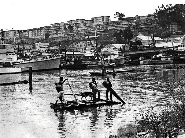
I was excited to go to meet whoever would show up at Bayview to Breakers: A Ragtag Regatta which wistfully & grandly called for ambitious, weird boats to explore the San Francisco shoreline without motors. We did meet a few awesome people hauling kayaks down a muddy rocky hill to the water, and we puttered around the south bit of the India Basin Open Space trail, making tiny drifter boats out of sticks and grass.
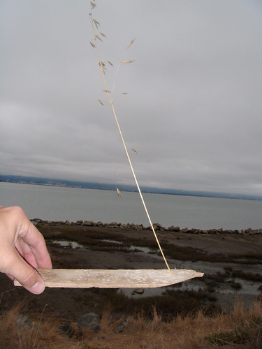
India Basin itself is in Bayview, between Islais Creek and Hunters Point.
Here's a detail from a great map on a postcard from the India Basin Neighborhood Association - more about them later!

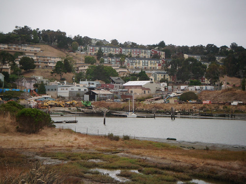
So, we started out in the Open Space III part of the park, down Aurelius Walker and looking south towards Open Space II and the power plant. The shipyard and docks between were very intriguing! I wish we could help fix those up. There are a few boats moored there and one hauled out on land. I wish there were still a ton of boats there.
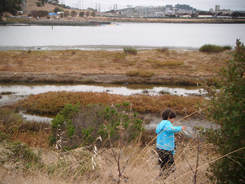
Check out what it used to look like in 1969! A lot more lively and alive. I wonder what changed between then and now? Awareness of the pollution issues? Some other "development" effort that came to naught but ruined what already existed?
We met Chris B., kick ass urban kayaker. Happy birthday Chris!
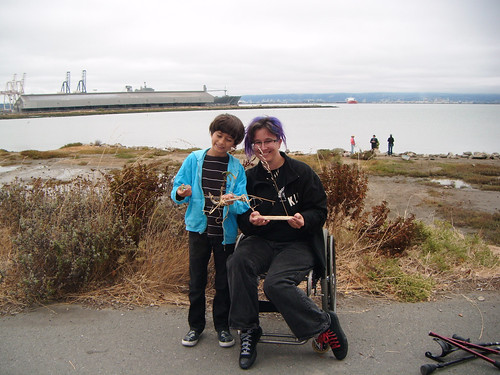
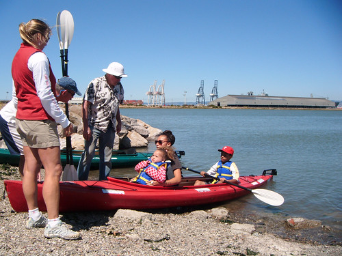
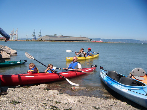
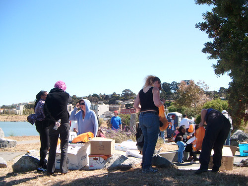
It was cold and drizzly but we had fun. I was dying to get in one of the kayaks. INstead we took off, went to a school BBQ, and came back when it was sunnier a few hours later, to the northern bit of the park. In between were a 24-hour ghost restaurant, the Surfside Liquor store, some housing, and The Box Shop which looks like a great artists' studio built from shipping containers. A couple of groups were in the park all day - America True, which runs boating events for kids, and the India Basin Neighborhood Association. They fed us, talked with us, gave us kayak and motorboat rides, and were great hosts.
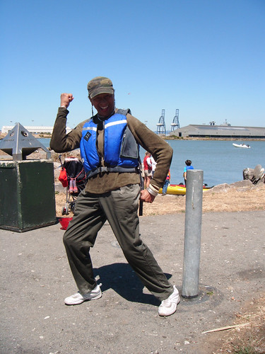
I met a very smiley person in a life jacket:
Melita told me some of the history of the struggle over the area's development. I always end up listening to long confusing meetings of the Hunters Point Redevelopment council on the radio and am a huge fan of Harrison Chastang's commentary on city and other news. Later I googled around and read up on the very interesting battle over whether Shipwright's Cottage was historical enough to be a landmark that would block some condo developer from building giant-ass condos on this bit of privately owned land on the San Francisco shoreline. Clearly the history of that is more complicated that I could absorb in an evening of reading. But I did find wads of city documents, meeting notes, EIRs, the fervid rantings of Francisco da Costa about White Lesbians (capital letters!) butting in to screw up India Basin, and this pathetic and hilarious plea from one of the land owners in question:

oKAY then... Anyway, as I looked at the shore and the docks, I imagined them all fixed up, not destroying what's there but with some more boardwalks and cafes and neighborhood businesses and a working shipyard and marina. Okay, it's polluted. Probably where I live is too. As long as I'm not smack on top of the radium dial disposal pit. (Or the bit that caught on fire underground in 2000, and they just dumped some more dirt on top of it and crossed their fingers.) I would totally live aboard there and run Community Kayaks. Get some historic ships in there but make it all integral to the community. Get a laundromat and a grocery store and fix up that amazingly cool 24 hour restaurant, not like some kind of attempt at a Fisherman's Wharf of the Southeast. And ... not some kind of nightmarish gentrification which everyone (except real estate developers) wants to avoid.
So about the real estate. How about Albion Castle... a stone castle right on India Basin with its own *caverns* and 10,000 gallons of water per day from the aquifer plus the rights to the brewery name. On sale now for only 1.8 million dollars...
This site, Community Window on the Shipyard has a focus on the Hunters Point Shipyard not India Basin, but it's a really good site that makes the official "INFORMATION" about the environmental mess and cleanup plans and progress easier to understand.
Also, here's a link to the India Bay Neighborhood Association...
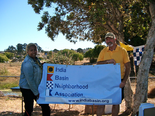
And back to our beautiful day in the Basin!
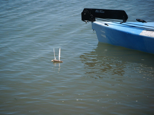
My son made a little boat, a two-master, that stayed afloat for an hour until the motorboat ran it over:
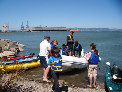
In the riprap along the water by the parking lot there's a gravelly slope that works well to put in kayaks. We met Dawn and Dan who were helping out and getting people into lifejackets. Dawn turns out to be Dawn Riley of America's Cup fame. Dan is involved with BAADS, which I just recently joined. Cool!
I got into a 2 seater Old Town "Loon" kayak and tore up the Bay! Me and Milo went as fast as we could. He counted so that our strokes would stay coordinated. We checked out the docks at the old shipyards and went around a buoy. After crutching around the rocks kind of awkwardly, it was great to speed through the spray and I didn't mind getting wet. Everything was sparkling in the sunlight. I like things like ruined docks and horrible old power plants and grungy marshlands and will definitely be back to kayak around this area. Then the kids had a ride in the motorboat, and I took another kid out in the kayak - he too was into going as fast as possible. We had fun and clearly he could have stayed out there a lot longer.
Afterwards we went to the EcoCenter in Heron's Head Park, just north of India Basin. It was gorgeous, but closed and looks like it's been closed since mid-July. I didn't realize this from the EcoCenter Blog! We enjoyed walking around it anyway. I like the way the tanks look, and the wooden walls.
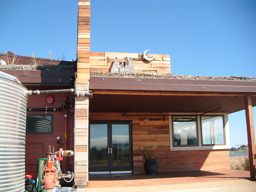
However, I find that Da Costa the environmental activist and slightly off base and racist ranter really, really does not like the EcoCenter or the Heron's Head park (or, really anything but the mythical golden past) because putting a park and a children's education center in the middle of a toxic waste dump is horrible. He kind of has a point there -- and yet visiting a park is a lot less horrible than building giant non-earthquake-safe condos in the middle of it all and seems like a good use of land that has been messed up. It means that someone goes there and has a reason to go there and a reason to keep cleaning it up. Here's some alternate reports and data on Heron's Head Park aka Pier 98 from Literacy for Environmental Justice, which you know is good and friendly because it's all in Comic Sans.
My thoughts on the shoreline: we could probably figure out how to test the toxicity of things in the area ourselves. Not like I know how, but it should be possible. Do some soil and water tests now and keep doing them! My other somewhat flippant solution is to put free (and compulsory) housing for the main City government people right in the worst spots. Make their kids go to school there too. Then they will have to haul ass to improve the situation. As a side effect, cowardly do-nothings won't dare run for office.
Since that won't happen anytime soon, I wish the neighborhood association luck in their plans to keep the shoreline for public use, for a maximum number of people to enjoy rather than for some gated condo community that a few developers make an obscene profit on out of exploiting the housing market. The shoreline is held in public trust and I like the idea of recreational use combined with historical preservation. To do any of that I think people need an awareness of the neighborhood's past and present and how environmental racism affects the community and the entire city.
Posted by
Liz
at
12:14 AM
0
comments
![]()
![]()
Labels: boats, ecology, san francisco
Friday, August 06, 2010
BlogHer Community Keynote - Geeky!
Here's my post for the BlogHer '10 Community Keynote. I'm still backstage listening to the other great readings! What a rush to read for over 2000 amazing, writerly, geeky women! I'm all like OMG Double Rainbow It's So Intense!
What Is Geek?
Today I was washing the flowered handkerchiefs my sister made me . When the hankies got wet in the sink I could feel all kinds of slimy mucus on there. I thought, what makes mucus do that? What's going on, chemically? Is there a scale of measurement to describe snot's ability to dry up and re-slime? Must look up viscosity!
Later that day I spent hours reading about soil science. That led me to giant government web sites, maps, explanations of whether the soil in my area was firm enough for tanks to cross, or soft enough for mass burials in pits. I absorbed the beautiful jargon of the taxonomy of soil.
Then I had this weird flash, like time travel, where I was mentally telling all this to this girl Susan I knew in middle school. I could see her very kind but skeptical smile. This imaginary Middle School Susan sighed and said I was SUCH a geek. She said I was "like a boy".
Another moment popped into my head. At BlogHer 05, when Mena Trott from SixApart stood up and started babbling about knitting blogs. I kind of freaked out.
I was like, OMG, CNN is here! I thought you were going to represent, and be my computer programming coder rock star and instead....you're talking about knitting! How embarrassing! We were finally getting noticed as women doing stuff on the web not just as blog writers but as deeply technical women and now... knitting?!!!
I tried to suspend my judgement, persuading myself, "Well, women DO knitting and, women talking to each other on the Internet is inherently good, so, I guess it's good they find each other there and talk about what they like, which is this trivial, stereotypical, embarrassing, girly thing, it might as well be talking about Barbies and painting our nails."
I could see Mena knew she was being misunderstood and that the media was going to mangle her message. As I thought about this over the years, I understood the dynamic of what was happening. I'm so sorry for my ignorance and my misogyny. I was SO WRONG.
Now I know that knitting a sock is this AMAZING thing -- like building a suspension bridge, a feat of engineering, and is like code in that it is ... code.... but made out of physical stuff.... Textile geeks have patterns that are code that convey technical information. They reverse engineer and re-invent marvellous things, knitting coral reefs and digestive systems and enormous protein molecules along with socks and sweaters. Now I'm a knitting groupie. I signed up on Ravelry just to swoon over the textile rock stars.
As I washed my snotty handkerchiefs I thought about boys in middle school. While my being a geek made me "like a boy", being a geek, for boys, meant they were called girly or gay. Being weird meant that gender norms could be used against us. For geeks who were boys and then men, I think this influenced and still influences a defiant need to define geek as male. Geek macho insists on hetronormativity, defines girls as a thing apart, claiming geekiness for manhood.
I'm not a knitter. But I do have SOME skill with string. I can play cat's cradle and make string figures. Like hand-clapping games and jumprope rhymes, string figures are passed from girl to girl over the years.
It strikes me we could learn something crucial, as geeky feminists, from the pattern of how young girls pass on this knowledge, and how that is presented as gendered knowledge – as something “girls know how to do”.
Single crochet is just making a loop with your fingers and thumb, tying the same sliding knot over and over. It teaches the skill of maintaining tension on a strand. It's a useful skill to make a weak cord into a stronger, thicker one.
It's what you pay attention to.
It's a stance towards knowledge and doing.
It's about communicating knowledge and process.
I learned everything I knew about string from other little girls. Though I didn't realize it, that was my introduction into geek sisterhood. Teach your geekiness, and pass it on. It's what girls know how to do.

(posted originally on Dreamwidth - this is the edited version to fit it in under 4 minutes)
Posted by
Liz
at
2:29 PM
1 comments
![]()
![]()
Friday, July 30, 2010
The saga of the Alviso Boat Ramp
The opening of the Alviso boat ramp looked pretty cool. Kayakers and dragon boats gave free rides to whoever showed up, and they had a big party. Chris Pereira-Ponce has a great photo of the ramp.

Go, Alviso! Very cool!!! A long fight that led to free public access to this place that might actually see some use. It could lead to other nice, small scale development that gives people access to the water and shoreline.
The Inflatable Kayak blogger wrote up the launch, with photos. The slough is peaceful, calm, and full of birds, and looks like a great place to kayak.
I found a government record of the project: Alviso Marina County Park Boat Launching Facility Project Blog. There was a meeting in 2005 talking about potential Requests for Proposals. They thought the ramp would be finished by 2006. Ha! After 2 years of entries that read "Status remains unchanged", here's how far along things had progressed:
Wednesday, October 10, 2007
Per Santa Clara County: due to construction calendar constraints as dictated by permits, and the award of the needed grant funding for the project in September 2008, the first foreseeable construction window is considered to be starting June 2009.
Updated: Friday, January 18, 2008
Permit issues, funding issues, land control issues, and environmental concerns have led to unforeseeable delays to this project.
I'd love to know the story behind that, and what the permits, land control, environmental concerns, etc. really were! Yikes!
This summer the ramp opened. It cost 2 million dollars to build. It goes into a narrow slough that's about the same depth as Redwood Creek in the area where I live -- with a low tide channel depth of 4 feet.
There's a local politician proposing a port, with restaurants, an IMAX theater, and a tiny ferry. That scale of port seems quite unlikely! Get real! How about some decent public bathrooms, boat rental, and an ice cream shop?
I wonder why my town doesn't do more with the waterfront it has. Here we have a great creek, we already dredge the channel every few years, there's at least two officially public boat launch ramps into the creek, and yet our waterfront is barely used. Not that I want an IMAX next door. It does seem like there could be more small businesses and it could be much more of a nice destination for local people.
Anyway, I'd like to take my kayaks to Alviso Slough to take a look at what's there!
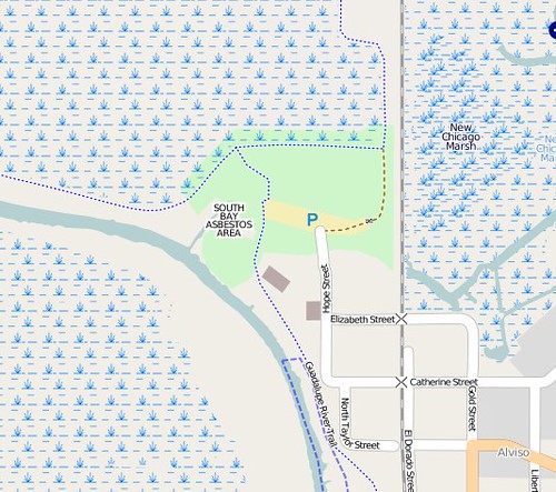
You can see from the map that the area of the boat ramp is marked "South Bay Asbestos Area". Mmmm! Asbestos! I think also a lot of mercury comes down the Guadalupe River from the hills. But seriously, that doesn't bother me. IMHO if it's polluted, stick a park on it, put up some warning signs, and start to work on reclamation. I'm going to kayak through the marsh, not roll around it or lick it, and if I fall in I'll take a shower afterwards. I'm sure whatever pollution there is about a million times less horrible than one afternoon working in a dry cleaners. Anyway, people live there, on that worthless neglected marsh that then gets sold off in chunks to Cisco for umpty-gazillion dollars so they can build some giant parking lots on it.
So, 2 million dollars! Could you build a decent boat ramp meant for kayaks for less than 2 million dollars? I could.
Posted by
Liz
at
6:40 PM
0
comments
![]()
![]()
Friday, June 11, 2010
What it might mean to make maps
We have now mapped the tiny corner of our creek and given names to nameless places, extending human dominion to yet another junkyard and mudflat. 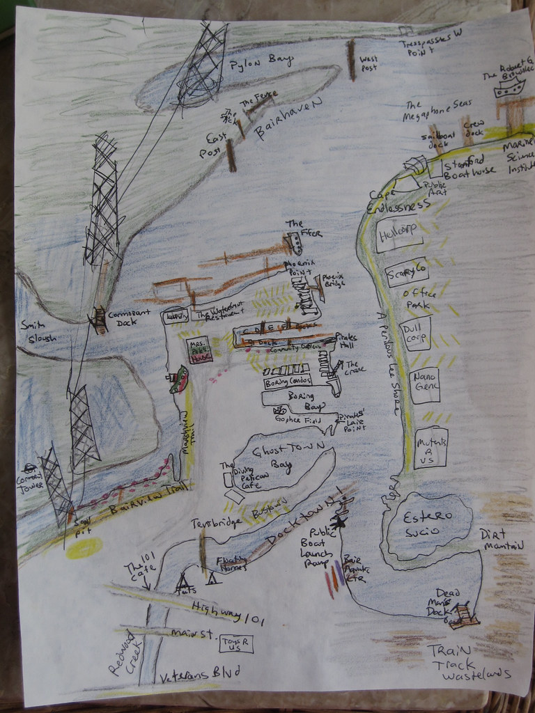
As I kayaked around with my friend Adina she babbled to me charmingly of how we were in the same place but in a different place. Everything about the land and the water became different because we were on the water looking at the land. I agree! Distances open up hugely and pinch themselves up into almost nothing depending on the wind and current and tide. The parking lot of an office, a boring place, turns out to be the best fishing spot on the creek, full of families hanging off their truck tailgates.
Many of my names for the creek are jokes but they reflect the way we are using the creek as kayakers and what we think is important. The places where trash collects, the strength of the current, the mudflats, the sticks and pilings and pylons that are landmarks, the place where the grebes hang out, the wind shadow of Middle Bair Island.
We remap our minds by traversing the edge of the known map. I was thinking about frontiers, wastelands, and edges. At Open Source Bridge I said some stuff about wastelands. When you hear a place described as empty, reach for your gun. Just kidding. No, when you hear a place described as empty, you can be sure someone is exploiting it. The desert, the wasteland, and the frontier, are obfuscations.
So in my naming of these places I open up different possibilities of exploitation, but since no space is unnamed and unobserved -- they are named and observed and mapped by governments and corporations -- I would prefer that they be named and observed in a decentralized way by anyone at all. (Which is one reason I adore Open Street Map and Open Sea Map.)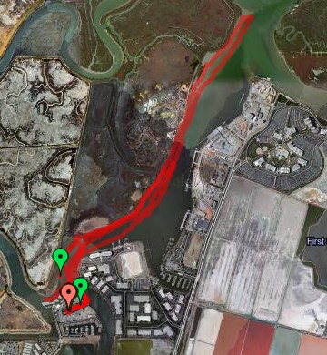
As I look back on the history of Bair Island and Redwood Creek I keep finding ghost places - like "South Shores" which was an attempt by a developer to rename the slough as a suburban extension of "Redwood Shores". Or like Deepwater Slough, which still has a faint track on the satellite photo - the C shaped trace that loops across Middle Bair, across from the Port - the dredged mud and pickleweed it encloses still privately owned and still named "Pacific Shores" probably for some totally screwed up future condo development scheme.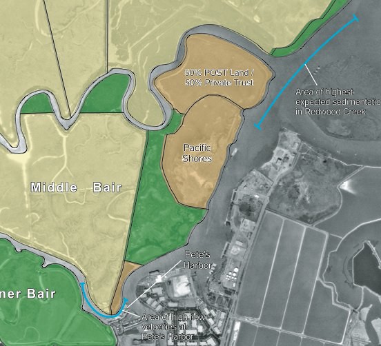
The Bair Island history, its battles, and its 2006 EIR are all deep background good for anyone interested in the proposed 12,000 household development of the wetlands-turned-salt-ponds owned by Cargill. On the maps they're the pink rectangular areas that barely even look like bay anymore.
A neighbor of mine across the harbor is gearing up for that battle on another blog, Virtual Saltworks. The ponds are still part of the bay and still supposed to be open space and wetlands. We could use a little bit of digging into maps and history - what was First Slough like before it was diked? What would it take to restore it at least to the state that Bair Island and Corkscrew Slough are in now?
Soon the abandoned docks and the piers for electric company access to overhead cables will be decorated underneath by pirate mailboxes where Milo and I will leave secret messages for the world.
I have some great ideas for Community Kayaks. They'd be like the civic projects for free bicycles anyone can use without fuss. It would be very easy and cheap to start and maintain a simple flotilla of boats free for anyone to use. More local people would use Redwood Creek, would see the edge of our town, the cultivated-wild places that exist right next to the industrial port where oceangoing cargo vessels offload their gypsum, sand, and gravel and load up clanking waterfalls of scrap metal. People barely care about the Creek because they don't know it's there. If they paddled around on it they might get fond of it.
I got a little obsessed with the Alviso boat ramp opening. If you live in Redwood City - do you know where the public boat launch ramps are? There are two that I know of!
What is the Bay for? Who gets to go on it? You shouldn't have to be rich - or go on a giant ferryboat - or treat it like a sort of horrible wet golf course -
Where are my beautiful floating islands made of trash and full of ecological minded Burning Man hippies cultivating flats of pickleweed and nesting habitats for Caspian Terns? I also imagine a beautiful anarchosocialist cooperative marina with art projects and rogue marine science. It would be easy for us here in the harbor to be monitoring water quality, observing the plants and birds and fish, and so on. Decentralized maps and some kind of visionary open data project could make for some great open source science - I'm sure someone's doing this already.
Posted by
Liz
at
5:01 PM
0
comments
![]()
![]()
Labels: boats, ecology, maps, open source, Redwood City, Redwood Creek, science fiction
Sunday, June 06, 2010
Birds of Redwood Creek, Bair Island, and Smith Slough
I've been steadily exploring Redwood Creek and the slough around Bair Island from my houseboat in Pete's Harbor, getting to know the birds of different seasons and the plant life as well as the patterns of wind and current. The human activity on the creek is mostly from tiny boats puttering around from Docktown to Pete's Harbor to the city marina; tiny planes overhead on their way in and out of San Carlos airport; sailboats and crew and outrigger canoes from Bair Island Aquatic Center and the Stanford boathouse; and further downstream, the huge, fascinating, industrial Port of Redwood City.
I'll start with the birds.
Brown Pelicans are fairly common. There were many living in the harbor itself over the winter, but they began to migrate elsewhere in the spring months. There's always one or two out over Redwood Creek next to Bair Island, gliding and diving. They perch on pilings and sit on the floating docks near my boat, wary but tolerant of human approach. You've probably seen the heartbreaking photos of pelicans covered in oil from the BP oil spill in the Gulf of Mexico. Here's some happy pelicans who live in Redwood City to cheer you up!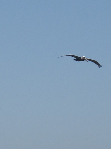

Terns, possibly more than one species of tern, showed up in mid-spring and are swooping over the harbor and river, catching tiny fish. They make a funny clicking noise almost like blue jays scolding. While I'm kayaking, terns fly right overhead and plunge into the water a foot or two from my boat. They're incredibly graceful and a bit saucy. You can tell them from gulls a long way off from their swooping flight, black head, long beak, and curvy wings.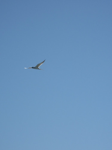
Great Blue Herons are a bit more rare. I see them most commonly in the early morning, evening, or far into Smith Slough away from the harbor itself. But they come into the harbor and hang out, even perching on dinghys and boat rails. When we see one, we stop paddling and glide as slowly as possible so as not to disturb it. They're very shy. 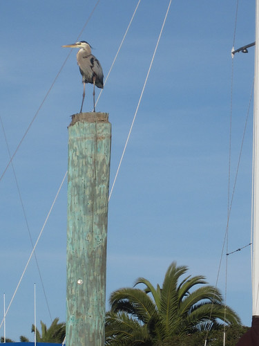
Egrets are easy to spot all over the Bair islands, often visible from the Pete's Harbor parking lots on Inner or Middle Bair or from the viewing trail. From the kayak, I most often see them in the tiny inlet we call "Pylon Bay".
Western Grebes come right into the harbor, but they can almost always be found in a little flock next to Middle Bair Island right where the slough meets the creek, between Pete's Harbor and the Marine Science Institute. They scatter when the crew boats row by in the early morning and evening. I've seen these grebes do the preliminary steps to their mating flights -- pairing up and head pumping, copying each other, but not the full "walking on water" part. The grebes are everywhere in Redwood Creek and seem to be very successful in their fishing.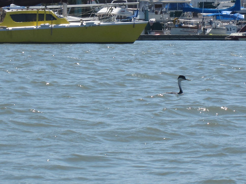
Coots are around, but less common in the creek. We have one resident coot who hangs around C and G Docks in the harbor, named Wacko by my neighbors. It hovers around the little flocks of ducks and sticks close to the shadows of the boats and docks during the day.
Ducks, seagulls, and small Canada Geese are extremely common around the harbor and Bair Island. I feed them (and Wacko the Coot) handfuls of duck chow in the evening from the back of my boat. A couple of weeks ago, I saw three pairs of Canada geese with 7 chicks, between the Bair view trail and Inner Bair Island, but the goose families with goslings haven't come into the harbor. My neighbors have said that every year the ducks have lots of ducklings, most of which don't make it to adulthood as they get eaten by herons and seagulls.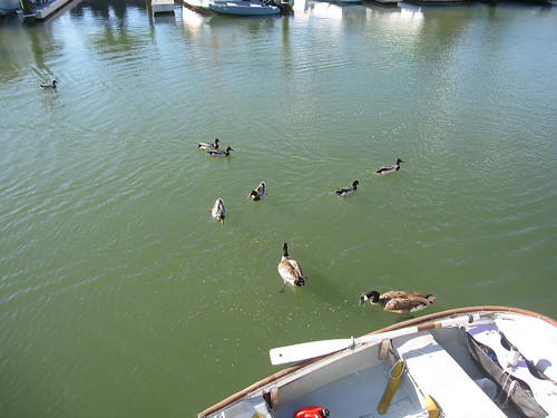
During a low tide, especially a minus tide, we see a lot of night herons. They're very shy and wary, but they still perch on the docks to fish. It's nice to see them out on the mudflats in a minus tide, along with phalaropes, plovers, peeps, black necked stilts, avocets, and what I think might be whimbrels. I love night herons because they look so fierce and grumpy.
I don't have many photos of the avocets and stilts. I see them most often at the minus tides or way out in the slough. The closest point I expect to find stilts is in the slough in between Inner Bair and Middle Bair Island. Here's a stilt right by Pete's Harbor at a minus tide in the early morning, near the place we call Castle Point.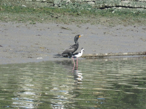
Cormorants are common and quite beautiful! They and the pelicans remind me of little dinosaurs. We recognize them a long way away from their low sleek profile sitting on the water, very different from the shape of a grebe, or from their characteristic posture perched on pilings, docks, or pylons, with wings outspread. The dock near the pylon across from the Pete's Harbor laundry room, and the pylon itself by the Bair Island viewing trail, are pretty much guaranteed to be festooned with cormorants any time you look. I conclude that they must make a successful living from the creek and the area immediately around the harbor. 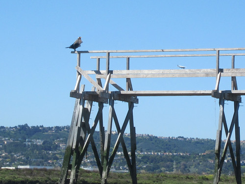
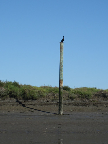
Red tailed hawks glide over Middle and Inner Bair Islands, hunting. Some small mammals must live there. A few years ago I saw rabbits boxing each other on Inner Bair, while it was still home to a hiking trail.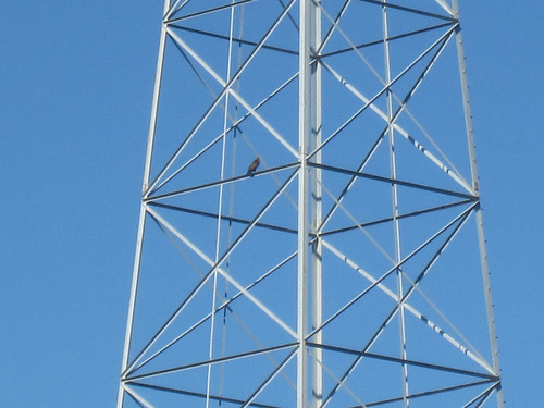
Though I haven't seen a Clapper Rail, I'm pretty sure I've heard one over by Inner Bair Island: they sound like creaky machinery.
On Bair Island itself, there are swallows, red-winged blackbirds, finches, and other small songbirds I haven't identified.
You can see quite a lot of these birds from the Bair Island viewing trail or from the Pete's Harbor parking lot near the Waterfront Restaurant. To get to the viewing trail, get off Highway 101 at Whipple and go on Whipple towards the Bay, away from the city. You will pass some car dealerships and the old movie theater. The road curves around to the left, past the foot and bike bridge that goes across the creek to Main Street. Keep going past the Diving Pelican Cafe. Across from the Bair Island condos and a big empty field, just before the railing, road, and walkway that leads to the Pete's Harbor ship on land that's painted like the Italian flag, there is a tiny trail and a "Shore Access" sign. Park in the lot across the street from the trail.
Along the gravelled trail, there are two natural history signs that have information about the marsh. There are benches where you can sit to look out over the slough. If you walk about halfway down the trail towards Whipple, there is a tiny sand pit and playground good for toddlers to play in. Bikes can make it up this trail all the way to Whipple. Strollers are okay up until the halfway mark at the sand pit. It's not very accessible for wheelchairs but not impossible if you can make it up the steep gravelled slope that starts the trail -- I can make it only with a push from behind, but can do the trail after that despite the shallow gravel up until the sand pit. Past the sand pit, the trail is narrow and rough.
Leave a comment if you birdwatch around this area and let me know what you see!
Posted by
Liz
at
10:20 AM
0
comments
![]()
![]()
Labels: bair island, birds, boats, Redwood City
Monday, May 31, 2010
On the road in search of olive tea towels and bits of granite
Yesterday we drove up I-5 to Grant's Pass. Here's all the things I noticed and enjoyed.
Coming up 505 there were lots of flooded fields that I thought might be growing rice. I fell in love with the lady behind the counter in a Carl's Jr. somewhere along the way because she seemed so sweet and earnest and vulnerable, like the heroine of a Patsy Cline song. Everyone else in the Carl's Jr. knew each other and talked about their plans for the weekend, asked after family members, and so on as their kids and grandkids played on the play structure. A guy who in former decades I would think of as a hesher came up to me. "Love the wild hair, I have to show that to my son - his favorite color is purple."
Further along, in Corning, after about 1 million billboards for a place called the Olive Pit, I got off the highway and had a similar experience in the Travel America truck stop. A woman in a TA vest liked my purple hair and yelled "Hey Mom! Come on over here!" They liked my hair and then I went to the bathroom passing a big sign for Trucker services in the Trucker Chapel. Wow, a truck stop with a *chapel*. I had this picture suddenly come into my mind of the Holy Grail appearing and disappearing at a truck stop feast table near the combination pizza hut and taco bell. There were two other obvious OLIVE *** places so I went down the road to the Olive Hut, a big round topped metal building with plastic barrels outside. Not sure what I was hoping for; I love olives, olives with weird things in them, and felt there might be a warehouse full of kitsch, and if I could get an Olive Capital of the World magnet or tea towel something in my soul would be road-trippishly satisfied. Alas, no trinkets but a mostly empty echoing warehouse with some very nice and cheap olives. I tasted and bought chipotle and garlic-jalapeño stuffed olives plus some slightly out of place salt water taffy. The kitsch was probably all at the place with the billboards. I pictured big fiberglass olive shaped structures making up a playground and photo opportunity, where you could get into the fake olive with your head sticking out and take a stupid picture. If that doesn't exist, it should...
There was an interesting sign somewhere along the way, "Stop the Thermal Curtain! Save Lake Almanor!". A thermal curtain (said my driving companion Oblomovka from browsing on his phone) is a thing they install at the bottom of deep lakes to stir up the cold water that sinks to the bottom and sent it out and down stream to benefit the fish, or fishermen, or both. "Waiit a minute is this something that the power companies say is for the environment but is really to offset their own thermal pollution..." Not sure and I need to look it up. The "save the lake" guy sounds slightly batty on his web page. I want to believe!
Must go to Lake Shasta Caverns on the way back, OMFGBBQ! A boat ride, bus ride up the hill, and then CAVES. I love a cave, wet or dry. Show me the flowstone, baby!
We got off the highway again at Weed to go to the Silva BBQ, which was very good but very, very salty! It's worth a stop for the amazing view from their deck of Mt Shasta and the Black Butte volcanic plug. Thank you, Roadside Geology of Northern California, for all the great explanations of geologic features. I failed to buy some funny postcards that said "WEED" on them.
A brief stop to lie in the grass under the trees at the Rogue River state park ... I get very stiff while driving and have to pee like once an hour and am very curious about the things nearby the highway, in case you're wondering why I stopped like 6 times on what should be a 4 hour drive... I thought of how if I were younger I'd be climbing all the trees in this rest stop and running down to the riverside but it was the end of the day and nothing other than lying on a picnic blanket was going to happen. The wind picked up as we lay there and made the tops of the tallest pine trees sway beautifully like little anenome-like tentacles of branches of coral.
In Grants' Pass we stayed at the Sweet Breezes motel, very nice, with a funny pink painted sink, funny green splotches decorating the bathtub wall -- someone learned to paint porcelain. A bookshelf with readers digest condensed books. A slight carpet cleaner smell but it aired out and was tolerable. A fridge and microwave (no coffee in room - only in the lobby) and nice bath stuff. Pink and green towels and bedspread, rather sweetly matching the painted sink... someone made an effort.
Dutch Brothers coffee kiosk. More chit chat which I got to overhear. Two guys in the kiosk argue about breakfast place advice. Ray's Supermarket breakfast burritos (tempting!) Della's for a step up from Denny's and some people say it is the best breakfast in town. I drove around with my coffee seeing the preparations for Boatnik.
Ended up at the Powder Horn Cafe which was a classic and gorgeous little diner with longhorn horns over the menu on the back wall, a case of homemade pies (flavors chalked up on a board nearby) and a waitress with a lot of eye makeup and one of those sarah palin hair thingies calling me honey. I adored all the waitresses. A lot of people in here look like regulars and all chat about their weekends to each other and the staff. The rye toast was not the gross kind that has been in the freezer for years but was fresh, thick, and soft, eggs nice, homemade hash browns (a LOT of them) and coffee at my elbow topped up every 5 minutes. They had a charming thing called Table Talk with knock knock jokes, funny headlines, local history and so on. I'd go there again, especially for rhubarb pie. They were really nice even though I was an out of towner and taking up a whole table with my newspaper and notebook and giant plate of cheap poached eggs. (Breakfast was... 6 dollars total with tax. !!)
Other bits of Grants Pass that I noticed while driving around: the caveman statue, cute downtown with ads painted on sides of old buildings, a piercing shop, something with a betty boop sign that could be a sort of homegrown hot topic for the alty teenagers, a theater where Henry Rollins is coming tomorrow to do spoken word (!!!!!) Cute well maintained small businesses everywhere so a) it must be cheap to live here b) the city must encourage and foster them very well. I thought the downtown was missing a hotel or two or fancy bed and breakfast - instead the motels are all near the highway, understandable, but as a tourist I prefer to be right in the cute downtown where I can walk (or wheel) to everything without getting in my car.
In my little fantasy world (where there are also giant olive sculptures and Olive Capital tea towels) I putter around the tiny shops, cafes, small town history museum, and riverside park without having to drive and park and drive and park. The local paper described Boatnik, a 50 year old boat parade and picnic, sounds like fun, beer drinking by the river and so on, lots of small town competition of who can build the coolest float and I'm always a fan of that, eat your heart out pretentious Burning Man artists. I would SO go to Boatnik! As long as no one beats me up or anything - I find small towns fascinating but a bit scary, to be honest! Clearly Grants' Pass is trying to transition from being a logging town to being a tourist town and they're doing a good job of it.
Onward to Portland! My goal today is to pick up some rocks from a stream bed! It would be nice to see something that isn't serpentinite ... how sick I am of the Franciscan Melange. Some granite maybe - is that too much to ask? The problem here is that I can't walk all that far, so it has to be a riverbed right next to a parking lot.
I forgot my camera so the photos of this trip will all be cameraphone. Everything is so lush and green and rainy here!
Posted by
Liz
at
10:10 AM
0
comments
![]()
![]()
Labels: california, oregon, travel
Saturday, May 29, 2010
Morning trash from Redwood Creek
Here's the kayak full of trash I picked up early this morning at low tide in Redwood Creek. It was a short, leisurely voyage in a glassy calm that made it easy to spot floating plastic bags and bottles. 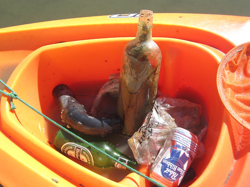
The big glass bottle looks old to me, so I'm going to wash it out and keep it.
During unusually high tides there's usually a lot of fast food containers, plastic bottlecaps, and styrofoam packing peanuts as well as a lemon or two.
Most of the time I forget to take a photo, but here's another day's worth of trash: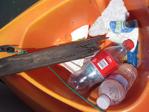
The most fertile grounds for trash are right up Redwood Creek past Highway 101. It's only good to go there during a high tide at slack water.
On Valentine's Day this year the Peninsula Yacht Club at Docktown led a big effort to pull trash from the creekside. In one day, they hauled out almost 2 tons of junk!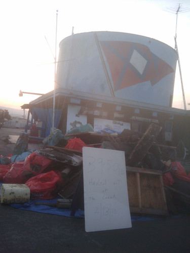
I think in the summer, Beth from Fake Plastic Fish might come do a trash collection voyage with me. Her blog is pretty cool - take a look. She lived for a year without consuming more than 5 pounds of plastic and she's basically an activist against unnecessary plastic. After collecting trash from the creek, and during moments like watching seagulls fight over a coke bottle screw top and then one of them eating it, I can sure see where she's coming from. The plastic bags in the marsh look like jellyfish floating.
In the Maldives there is an island made entirely of trash, Thilafushi Island. It's built out of garbage and looks like an interesting place despite surely leaching out pollutants and hosting some industrial processing plants.
The island has grown to such proportions that it now has a café, a restaurant, two mosques, a barbershop, a clinic, a police station and rather unexpectedly, a makeshift zoo.
If we had a floating trash island in the San Francisco Bay, its growth would need to be limited, but it could be a very interesting place for eco-tourism or trash management tourism. I picture this floating trash island as a step further than Forbes Island or Spiral Island II, but smaller than Thilafushi. It could be a colony where people come stay and camp for a month and do volunteer Bay cleanup work with Trash Island as their base. There should also be a coffee cart and a nature center. It would be way more exciting to visit than Yet Another Bike Trail with Dogwalkers And Joggers In A Landfill. The price of admission would be that you take away a bag of trash. Okay, this is a half-baked idea... While I like the vision of seasteading as places for independent states, I tend to come up with slightly less ambitious ideas for cooperatively owned marinas or coastal cities with floating platforms that share some common purpose or radical politics -- ecological cleanup and monitoring, public coastal access, and maybe some really cool art. In fact, I think that seasteading colonies will need to foster marinas with progressive politics in order to be viable. Seasteading needs a sort of marine-stuff-ecosystem in order to be viable. That might mean developing a close relationship with a working port city, or buying up and running its own port.
Speaking of public access! You should go to the Alviso Public Boat Ramp re-opening! Free kayak rides for kids and I'm sure a great party in a place with a long, interesting history.
Posted by
Liz
at
11:31 AM
0
comments
![]()
![]()
Labels: boats, discardia, politics, san francisco
Saturday, April 10, 2010
Warm Cove Park and Pier 70
Today's random expedition led me to Potrero Point and Warm Water Cove, a tiny, gritty park one step above a vacant lot in an industrial wasteland. It's a vacant lot in an industrial wasteland with a bench! I love this park. Right now it's full of wild mustard, radish, dock, mallow and other great edible plants. The remains of a creek ooze out of a scary tunnel. It's all surrounded by warehouses, parking lots surrounded by barbed wire, and off in the distance, rusting ocean-going cargo ships. Apparently there used to be weekly punk concerts there run off generators and lots of campers. While I was there today a woman and a dog in a very DIY camper van were doing some housekeeping and enjoying the late afternoon sun, so the camping, or homeless-person-occupancy, probably continues despite the recent community makeover, graffiti cleanup and daily policing. A few years ago people were still fishing from a pier to take advantage of the warm water coming from the power plant outfall (which attracts fish.) The pier's gone now.
Sounds like a lot of piers have been closed over the last few years, including San Mateo Pier, the longest fishing pier in California.
From there I could see a very interesting building that looked like a lot of cubes piled up on top of each other. 
It's behind the Pacific Gas & Electric Station A, a huge and beautiful red brick building. 
Here's some links to the history of Potrero Point:
* Station A
A block or two north, little alleys wind around the decaying buildings of Pier 70.
* The Noonan Building
* Map of Pier 70 structures - a great map with notes for each building.
* Irish Hill This hill full of houses and apartments for the iron and steel mill workers and their families was leveled and the rubble used to fill in the Bay. I saw a tiny bit of the hill left - you can tell it's not just a pile of dirt because it looks like a roadcut through serpentinite.
Underneath these industrial buildings is a tide-washed labyrinth of slag pits, cisterns, waste dumps, and wooden pilings. I can't even imagine the giant amounts of toxic junk still leaching into the Bay.
Building 104, an office building from 1896:
Building 21, from 1900.
Building 11, The Noonan Building, 1941. People obviously live there.
During wartime this shipyard churned out countless ships. Thousands of people worked there in round-the-clock shifts. As the shipyards closed the area became neglected and used for storage for old cars, MUNI trains and buses. It sounds like then there were decades of concern from people in the Dogpatch, Potrero, and Hunters Point communities, plans for redevelopment, toxic cleanup, reclamation, preservation of the historic buildings, and industrial customers who still might use the land for power plants, and ship building or repair. The largest floating dry dock facility in the world was sold to the City in the 1980s for one dollar -- probably because the massively polluted land (and ongoing pollution of the Bay) was clearly a liability and someone was going to have to *clean it up* before it got seriously used again.
As I mulled over What Is To Be Done here's what I thought up. While it's not being used for much else and it's polluting and dangerous, full of crumbling buildings and broken glass and probably more asbestos than anyone can imagine, make it a public Dangerous Park. Just let anyone do whatever the hell they want in there and graffiti it up and have punk rock shows and photograph the roofs of falling-down warehouses. But let them know the dangers to their health and safety -- just as you'd put up signs to say that a seaside cliff is dangerous because of erosion and high waves. The conditions of entering the Dangerous Park should be agreement that you're not going to sue the city for whatever injuries result.
Some of the Historic Buildings would be graffitied and fucked up, but maybe some would be improved, cleaned up, cared for by artists and colonized in interesting ways.
I realize this isn't going to happen and instead it will end up being a squalid industrial center for a while longer until some asshole buys it and Develops it, because the only way that people are "allowed" to be in or live on a toxic waste dump is if some bunch of developers makes an obscene profit off it. But people using crappy in land in some less centralized and profitable way is, weirdly, never okay.
Posted by
Liz
at
7:06 PM
0
comments
![]()
![]()
Labels: buildings, exploring, san francisco, travel
Wednesday, January 20, 2010
Connecting to a Pebble
I came into this room with a jillion people soldering and just finishing their Arduino pebble thingies and some madman crouched by my wheelchair to explain how to mindmeld with it. After a bunch of fiddling and more kibbitzing by a guy named Garth we got this other one working. I am incoherent! Because jetlag, and I'm in New Zealand at day something of linux.conf.au.
Here's how to do it! On a mac! Incoherently! And not quite like this, which is full of lies.
download arduino software
download drivers
You will have to restart your Mac.
download source of Aiko from github. (You do not need to go figure out github right now, just click on "download source")
move that into ~/Documents/Arduino and unzip it.
It needs to be like this:
docs/ nursery/
aiko_gateway/ examples/ pebble/
aiko_node/ libraries/ tests/
And in:
~/Documents/Arduino/libraries:
Aiko/ PString/ pebble_relays/
NewSoftSerial/ PString2.zip pebble_relays_aiko/
NewSoftSerial10c.zip pebble/ pebble_temperature/
OneWire/ pebble_display/
OneWire.zip pebble_ldr/
And thusly:
~/Documents/Arduino/libraries/Aiko:
AikoCallback.h* AikoDeviceSPIBus.h* AikoSExpression.h*
AikoDeviceMCP320x.cpp* AikoEvents.cpp* AikoTiming.cpp*
AikoDeviceMCP320x.h* AikoEvents.h* AikoTiming.h*
AikoDeviceSPIBus.cpp* AikoSExpression.cpp* Makefile*
You will be missing a bunch those files and the might not be in the right place. So move them around!
Download and unzip into ~Documents/Arduino/libraries:
http://www.pjrc.com/teensy/arduino_libraries/OneWire.zip
http://arduiniana.org/NewSoftSerial/NewSoftSerial10c.zip
http://arduiniana.org/PString/PString2.zip
Then plug in your Pebble! Yay!
Open Arduino application which you downloaaded earlier.
Select the Serial Port from the Tools menu.
Go to File--- Sketchbook -- aiko_node
Click Verify in the button toolbar
It should compile
Click the upload button in the toolbar
It turns on! yay!
Make sure to select the serial port in "Tools".
Click the Serial monitor button in the toolbar. It pops up another window.
select 38400 baud in the dropdown menu
Your Pebble should talk to you now!
thusly:
(node pebble_1 ? (temperature 27.87 C))
(node pebble_1 ? )
(node pebble_1 ? (light_lux 854 lux))
(node pebble_1 ? )
(node pebble_1 ? (light_lux 854 lux))
(node pebble_1 ? (temperature 27.87 C))
(node pebble_1 ? )
(node pebble_1 ? (light_lux 855 lux))
(node pebble_1 ? )
Tell it this:
(relay on);
(relay off);
(relay2 on);
(reset_clock);
You have now Impressed the Pebble. Name it something like R'duinoth. Huzzah!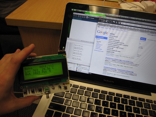
Posted by
Liz
at
1:29 AM
2
comments
![]()
![]()
Labels: electronics, fun, hardware
Friday, January 15, 2010
Beyond underwear: Useful things for crisis situations
A friend just asked me what would be useful to send to Haiti or to any evacuee camp, refugee camp, or disaster situation besides food, water, and medical supplies. She had the opportunity to send a box immediately by small aircraft and had to send things that were in her house already. So, here's my question for you. Other than food, water, and medical supplies, what would you list as non-obvious and useful in a disaster?
Here is my list.
Backpacks - things to hold other things
Tape - all kinds but mainly duct tape, electrical tape, and masking tape
Scissors
Pocketknife
Notebook
Sharpie markers
String or strong cord
Safety pins, binder clips, rubber bands
Ziplock and other plastic bags, all sizes
Handkerchiefs or bandanas
What would you add to that list?
My list is heavy on the office supplies but that's because I believe that information is power. With paper, a Sharpie, and some good tape, you become an instantly powerful distributor of information, because you can create useful signs that spread information efficiently. The list is strangely similar to what I'd recommend you need to organize an impromptu conference.
I still believe that along with food, water, shelter, and medical care, information is a primary need.
Given a point of internet access, priority should be on peoplefinding and information booth services. For peoplefinding, register people for email if they don't have it - Gmail is excellent- and on some existing popular social software. I think Facebook is ideal as they have okay privacy controls, useful for limiting volatile family details. Their neighborhood and group features are useful for finding, say, everyone you can think of who you work with or who lives on your block. Full names (which is what official databases go by) aren't useful when you're trying to make sure that lady who works on your shift or your neighbor "Bud" are okay because you heard that their sister's looking for them. Sign people up for email and make sure they understand how to get back into it. Sign them up on some social software, and friend them and get them to friend you back. You are now a point of contact for anyone who knows them. Do this with everyone you speak with, and you'll be doing something very useful!
In Katrina relief efforts I found that evacuees needed backpacks and tools to carry information -- notebook and pen, or a small folder or even a manila envelope, were crucial as they started to get paperwork, ID, and have to take notes on where to go for what resources, who they've seen, talked to, lists of people they're trying to find, and so on. Since officials, army and police would often just move cots and trash bags full of people's rescued (or newly received) belongings, a backpack is much better so people can carry essentials around.
Posted by
Liz
at
12:04 PM
6
comments
![]()
![]()
Labels: disaster relief
Saturday, January 02, 2010
Living in a boat
A month ago I moved onto a boat, a 37 foot Chris Craft Catalina built in 1987. The engine is in scattered rusted pieces. There's a faint bilgey, seaweedy smell and a gentle rocking motion. Pelicans, grebes, coots, ducks, geese, scaups, cormorants, and night herons hang around the harbor outside my window.
Last night for the first time, during a minus tide (a perigean spring tide) the boat grounded on the muddy bottom. Then there was a moment where the boat began to sway again - it had lifted off and we were floating. I looked out at the christmas lights in the rigging next door and realized we were at our usual height relationship again, with a view of the canvas roof over their cockpit. While we were both grounded, their deeper keel hit bottom first, and their boat towered over us so that I was looking into their lower portholes from my cabin window.
It's all a bit like a trailer park in a very wet parking lot. Some people's boats sail out into the bay or to far destinations. Others, like mine, stay put except for the promise and motion of the tide. People who have boats, and who live aboard their boats, seem to share a particular romanticism, dreaminess and the attachment of meaning to possibilities of a nomadic life, or a sense of needed refuge, shown in lists of the most popular boat names over the years.
Tides are complicated. On this part of the coast we get mixed tides -- with high water and low water twice a day, and one set of high and low points higher than the other. The tide moves north along the U.S. west coast because of the Coriolis effect. Here in the bay, down a marshy creek channel and in the middle of a slough, the tidal range is still over 8 feet. Floating docks and finger docks are loosely connected to piers by huge metal rings. Sometimes we on the boats, and the docks that bridge the water, are up at the level of the parking lot. At low tide, the ramp from the parking lot to the docks is quite steep.
Dock steps with a handrail lead up to my boat. Between the main cabin and the other rooms, there are a few more steps. These are still hard for me to negotiate, especially stepping down. But through the stress of moving I've held up very well. Now that I'm settled in, the constant small variations of the steps between rooms, with resting possible in bed or in the living room and kitchen, are making my knees stronger.
The head in the aft (captain's) cabin works well. The forward head has been in pieces for over a week, waiting for an out of stock valve to be shipped to one of a small group of my neighbors who have been in and out of the boat to study the valves and hoses below deck and the disassembled hoses attached to the toilet itself. I've learned a little bit about marine heads in the meantime. Everyone here gets to know the marine shop and the RV supply places, and, I think, the workings of each other's boats.
The boat had two circuits of 30 amps each. Space heaters, the microwave, and the toaster oven use the most amps and can potentially flip some circuit breakers. There's a 12 volt circuit too for the boat's batteries, and the bilge pump runs on that. Though the water and electricity are hooked up to the city services, I'm suddenly more aware of them as finite resources, and am now much more moderate in my use of both. My neighbors can see the water I use to wash dishes, as it's pumped out over the side. The toilets' holding tank is pumped out twice a month into a boat with a giant holding tank, with all our sewage sloshing around visibly inside.
A small subset of my books fills three half-size bookshelves. I brought a lot of books about exploration and the sea, fiction and non-fiction. So far the best one has been The Loss of the Ship Essex, Sunk By a Whale. Three survivors from the 1820 wreck of a whaling ship tell the story of the whale's attack, a long journey in three open boats, starvation, thirst, fear, and cannibalism. My other favorite book just now, a present from Oblomovka, is The Queen of Whale Cay, about a woman named Joe Carstairs who drove ambulances in WWI, raced motorboats, had about a zillion lovers including Marlene Dietrich, and bought her own island in the Bahamas which she ruled feudal or colonial style until the 1960s. Every paragraph of the book was full of new outrageousness. I also brought some books of poems to translate, and some of my favorite poets like Ginsberg and Alta.
By comparison to many other towns on the Peninsula, Redwood City has kept a little bit of its working class industry and feel, in part because it's a working deep water port. Ships from China and South Korea bring construction materials, like gypsum and rock for cement. They leave filled with scrap metal. On one side, a complex of tall buildings is built around a rocky artificial stream, then some salt ponds shade towards more slough and a landfill to the south. On the north side of the port, there's a yacht harbor surrounded by tech and genetics companies in a chain of long low buildings and their oceanic parking lots. Then, bits of slough and winding creek channels. At the point where Redwood Creek crosses 101, there's a marina called Docktown, with some enormous "floating homes" built on pontoons, and boats ranging down to the "barely floating" category. There are lots of flowerpots and dogs and amazing, attractive clutter, and a completely non-snooty yacht club. I like it there. My boat is in Pete's Harbor, a quiet marina just across the creek and around a point, facing Bair Island and Smith Slough. The liveaboards here all seem to know each other and it's a good community. Two newer marinas in town, West Point and Bair Island, are stricter in their rules and are out to attract a richer set of residents. But my impression of Docktown and Pete's Harbor is that people here are just regular -- not wealthy yacht owners -- and in fact it's very affordable to live on the water here once you have the boat and a slip to rent. The politics of the existence of marinas seems as complicated as tides and less predictable. Here is an area in flux, whose ownership is a bit unclear or is municipally owned. Would it even be possible to own a tiny bit of the coastline in the bay, here? Could it be possible for a consortium or co-operative to buy up some land and own their own personal boat slips, rather than renting the slips? I wonder, too, if that would inevitably lead to people filling in the spaces between docks and new land pushing outward into the Bay, as much of San Francisco was built on docks and filled in to become land, owned and controlled rather than the liminal space that coastlines seem to be.
As I read about the complexities of tides I learned about amphidromic points, places in the ocean where because of the Coriolis effect, the topography of the sea floor or the nearby landmasses, the tidal range is zero. The tides here keep me noticing things and alert to this small bit of the world. I'm paying attention to weather and watching the marine buoys nearest to the harbor.
Anyway, the changes in my life have been overwhelming and absorbing, so much that I haven't been blogging much or spending time online, other than for work. I need to jump back in, though, and in a couple of weeks am leaving for New Zealand for linux.conf.au and DrupalSouth. Wellington is on Cook Strait, between the North and South Islands of New Zealand. On the east coast, high tide comes at the same time as low tide on the west coast. So the current through the channel is fierce and for various reasons, nearly unpredictable. A bit like my interest in geology and gardening and compost made me notice dirt and rocks and want to learn about the geological history of every place I go --- seeing a landscape as a potential narrative over the scale of geologic time and simultaneously from the point of view of a gardener --- living aboard a boat (which happened somewhat by chance as I looked for a cheap place to live in my town on Craigslist) has given me a new overlay or template or lens to view the rest of the world. So there's a new set of things to learn and notice, everywhere I go, which makes me feel incredibly lucky and happy. The rock and soil based lens of my view is about deep history and rootedness, and how to settle and blend into that landscape, making a sort of habitat or ecosystem where I make a home for birds and bugs, getting back some tomatoes and oregano and flowers. Here on the water in my glorified floating trailer, I find I've made the same sort of cozy domesticity inside the house, but outside, there's no feeling of rootedness or connection. I'm detatched, ephemeral, temporarily in residence, trying not to make an impact with my biodegradable soap, an observer and traveller. What would it be like, living in a spaceship? It's like what that anthropologist whose name I can't recall wrote about the attractions of waiting rooms and hotel lobbies. But rather than waiting in an impersonal static lobby for a particular event, I'm a temporary resident along with the ducks and herons as enormous forces keep our world in flux.
Posted by
Liz
at
8:19 AM
4
comments
![]()
![]()


